Creating a Digital Twin of Forest
Stora Enso’s Precision Forestry program exemplifies our commitment to innovation, sustainability, and responsible stewardship of forest resources. The program uses modern tools and technology such as drones, satellites, laser scanning (lidar), and harvesting machines to collect detailed forest data for planning forestry operations and biodiversity actions. With this granular data, we can recognize tree species, tree height and diameter, and wood stock volume in the forest, as well as harvester location or forest damage caused by wind or insects.
Artificial Intelligence (AI) is in the core of Precision Forestry. With AI, we can combine the multiple data layers in our digital Precision Forestry platform and create an accurate Digital Twin of Forest. This enables us and other forest owners to map, model and manage ecosystems precisely, and at the same time maximize the value of forest assets.
5 ways to enhance forest management with Precision Forestry
- Optimized terrain routing for forest machines
Precision Forestry and its terrain data allow us to optimize the routing for forest machines, and to find the most optimal wood storage locations along forest roadsides. When optimising routes, the key is not only to find the shortest route to minimize CO2 emissions, but also to consider biodiversity and how best to protect it.
- Early detection of forest damage
With the help of data collected through satellites and drones, we can detect forest damages, such as spruce bark beetle exposure, much faster and more efficiently than the human eye. Bark beetle damage detection is in use in our own forest assets in Sweden. This service will be available also for private forest owners in Finland during this year.
- Efficient forest area mapping with drones and remote sensing
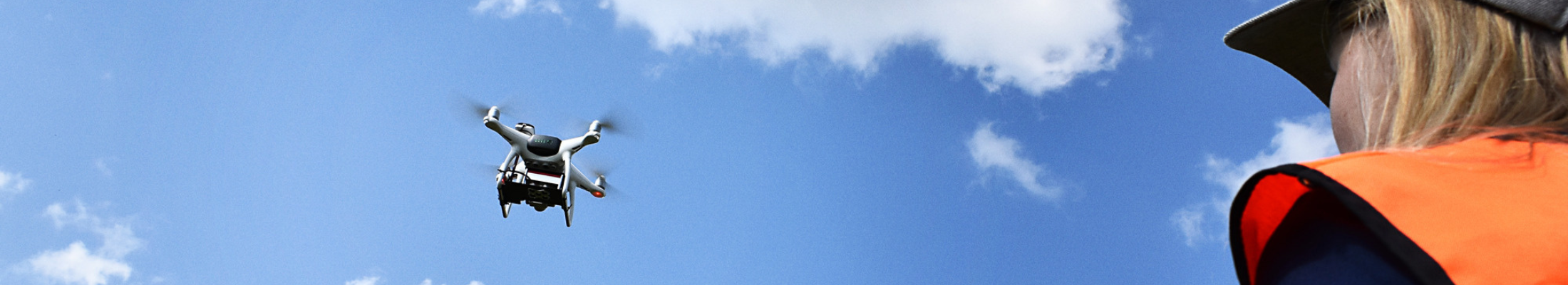
When mapping large forest areas, forestry experts can use drone pictures on a computer instead of having to map the area on foot. This greatly improves efficiency, as fixed wing drones can scan even 1,000 hectares of forests per day. In Finland, we are currently using drones to scan forests for tree and species mapping. This helps us, for example, to detect potential retention trees already before harvesting, leading to better forest management planning. In Sweden, we are also testing drones to analyse the forest harvesting footprint after felling.
- Enriched biodiversity data for Finnish private forest owners
By combining forest and biodiversity data from various sources, we can model and manage biodiversity and wood production side-by-side. This helps to ensure, that the forest management decisions we make today not only maximise the financial value for forest owners, but also have a positive impact on biodiversity.
In 2024, our goal is to make biodiversity data available for Finnish forest owners in our digital forest management application eMetsä. In addition to the traditional forest data, the new biodiversity data will include, for example, information about mixed species stands that have two or tree species, and no single tree species makes up more than 65% of stand volume, and information about stands where over 50% of trees are broadleaved. -
Achieving our biodiversity targets requires high-quality, auditable forest data
We have developed a science-based framework to verify our net positive impact (NPI) on biodiversity. The framework enables forecasting of biodiversity impact, which allows operations to be adapted towards a net positive goal. To achieve our NPI targets and measure progress, we need a wide range of auditable biodiversity data.
For example, in Sweden we are mapping standing deadwood and broadleaved trees, which are crucial for forest biodiversity. With satellite data, we can provide more precise information about the location of broadleaved trees within a forest stand, leading to better planning of protection zones and to the possibility to leave them where broadleaved trees are detected.

Continuous platform and business development
Precision Forestry represents a paradigm shift in forest management, leveraging technology to optimize productivity, conserve biodiversity, and mitigate environmental impacts. As an agile digital platform, Precision Forestry is constantly developed through several business projects. This requires close collaboration and data collected together with our internal teams and our external partners.
As technology continues to advance, the potential for Precision Forestry to revolutionize the way we interact with and manage forests is boundless. It offers new business initiatives, and opportunities for innovation and stewardship in the face of global environmental challenges. “This innovative approach not only enhances the value of our forest assets but also ensures that we can achieve a balance between economic, social, and environmental goals for a sustainable future.", concludes Jani Kaskinen, Vice President, Precision Forestry, Stora Enso.


